
Anúncios
Navigation has evolved beyond paper maps and internet dependency, empowering adventurers with offline GPS route applications that work anywhere, anytime.
Anúncios
Whether you’re hiking through remote mountain trails, cycling across unfamiliar territories, or exploring hidden corners of a new city, the ability to navigate without cellular service has become essential. Offline GPS route applications transform your smartphone into a reliable navigation tool that functions independently of internet connectivity, ensuring you never lose your way regardless of signal availability.
These innovative applications pre-download maps and route information directly to your device, allowing complete navigation functionality even in areas with zero connectivity. From weekend warriors to professional explorers, millions of users worldwide rely on offline GPS technology to safely reach their destinations while conserving data and battery life.
🗺️ Understanding Offline GPS Technology and How It Works
Anúncios
The magic behind offline GPS applications lies in the fundamental difference between GPS positioning and internet-based mapping. Your smartphone’s GPS receiver communicates directly with satellites orbiting Earth, calculating your precise location without requiring any internet connection. The confusion often arises because traditional mapping apps like Google Maps typically need internet access to download map tiles and route information in real-time.
Offline GPS apps solve this limitation by allowing users to download entire map regions to their device’s storage before venturing into connectivity-dead zones. These downloaded maps contain all the geographic data, street names, topographic details, and points of interest needed for comprehensive navigation. Once stored locally, the app uses your GPS position to display your location on these pre-loaded maps, calculating routes and providing turn-by-turn directions entirely offline.
The satellite signals that determine your position are always available worldwide, free of charge, and independent of cellular networks. This means that even in airplane mode, with all wireless connections disabled, your GPS receiver continues functioning perfectly. The only requirement is a clear view of the sky to receive satellite signals—typically four or more satellites for accurate positioning.


🏔️ Essential Features to Look for in Offline Route Applications
Not all offline GPS applications are created equal, and understanding which features matter most can dramatically improve your navigation experience. The quality of offline maps represents the foundation—look for apps offering detailed topographic maps with elevation contours, trail markings, and natural feature labels. These elements prove invaluable when exploring wilderness areas where roads don’t exist.
Route planning capabilities separate basic mapping from professional-grade navigation tools. Advanced applications allow you to create custom routes by dropping waypoints, following existing trails shared by other users, or importing GPS tracks from external sources. The ability to adjust routes on-the-fly, add alternative waypoints, and calculate distance with elevation gain provides essential planning information.
Track recording functionality transforms your phone into a comprehensive GPS logger, creating a digital breadcrumb trail of your journey. This feature proves particularly valuable for retracing your steps, sharing routes with friends, or analyzing your performance later. Quality apps record detailed statistics including distance, elevation changes, speed, and time stamps.
Map Variety and Coverage Options
The best offline GPS applications offer multiple map types catering to different activities and preferences. Topographic maps with contour lines suit hikers and mountaineers, street maps serve urban explorers and cyclists, while satellite imagery helps with terrain visualization. Having access to various map overlays within a single application eliminates the need to switch between multiple apps.
Geographic coverage determines whether an app meets your specific needs. Some applications specialize in particular regions or countries, while others provide worldwide coverage. Before committing to an app, verify it offers detailed maps for your intended destinations. Premium applications typically allow downloading maps for entire countries or continents, though this requires substantial device storage.
📱 Maximizing Battery Life During Offline Navigation
Battery consumption represents one of the primary concerns when using GPS applications for extended periods. The GPS receiver itself consumes relatively modest power, but the combination of continuous screen usage, processor calculations, and map rendering can drain batteries quickly. Implementing smart battery-saving strategies ensures your navigation remains functional throughout your entire journey.
Reducing screen brightness significantly extends battery life without compromising navigation functionality. Many outdoor environments provide ample natural light, making maximum brightness unnecessary. Consider using your phone’s auto-brightness feature or manually lowering the brightness to the minimum comfortable level. Additionally, most GPS apps offer dark mode or night themes that consume less power on OLED and AMOLED screens.
Airplane mode eliminates unnecessary battery drain from cellular, WiFi, and Bluetooth radios searching for connections in remote areas. Since GPS functions independently of these systems, activating airplane mode while keeping location services enabled creates an optimal power-saving configuration. This simple adjustment can extend battery life by 30-50% during outdoor activities.
Power Banks and External Battery Solutions
Carrying a portable power bank provides insurance against unexpected battery depletion during extended adventures. Modern high-capacity power banks offer multiple smartphone charges in compact, lightweight packages suitable for backpacking and long-distance travel. Solar charging options exist for multi-day expeditions where electrical outlets remain unavailable, though their effectiveness varies with weather conditions.
Battery cases represent another practical solution, integrating additional battery capacity directly into your phone’s protective case. These accessories provide continuous charging without requiring cables or separate devices, though they add weight and bulk to your phone. Evaluate whether the convenience justifies the added dimensions based on your specific activities.
🌲 Popular Activities Benefiting from Offline GPS Navigation
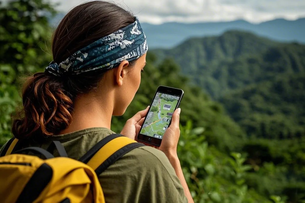
Hiking and backpacking represent the most common use cases for offline GPS applications, where trails venture far beyond cellular coverage. Mountain environments, national parks, and wilderness areas rarely offer reliable connectivity, making downloaded maps essential for safe navigation. Topographic features, trail junctions, water sources, and campsites appear clearly on quality offline maps, providing crucial planning information.
Mountain biking and cycle touring enthusiasts rely heavily on offline navigation to explore remote trails and backcountry roads. The ability to follow pre-planned routes without stopping to check printed maps or risk losing signal mid-ride enhances both safety and enjoyment. Many cycling-specific GPS apps include elevation profiles, surface type information, and traffic considerations valuable for route planning.
International travel becomes significantly less stressful with offline maps readily available. Rather than purchasing expensive international data plans or hunting for WiFi hotspots, travelers can download city maps before departure and navigate confidently throughout their trip. This proves particularly valuable in countries where language barriers complicate asking for directions or reading street signs.
Adventure Sports and Specialized Navigation Needs
Rock climbers, kayakers, and cross-country skiers benefit from specialized offline GPS applications catering to their unique navigation requirements. These activities often occur in remote locations with challenging terrain where traditional navigation proves difficult. GPS waypoints marking climbing routes, river access points, or avalanche-prone slopes provide safety-critical information accessible even without connectivity.
Geocaching, the worldwide treasure-hunting game, fundamentally depends on precise GPS coordinates leading participants to hidden containers. While urban geocaches might exist in connected areas, many premium geocaching experiences hide in remote wilderness locations requiring offline navigation capabilities. Dedicated geocaching apps with offline functionality open up thousands of additional cache opportunities.
💾 Managing Storage Space for Offline Maps
Downloaded maps consume varying amounts of storage depending on their detail level, coverage area, and map type. A detailed topographic map of a small region might require only 50-100 megabytes, while an entire country with multiple map layers could demand several gigabytes. Understanding storage requirements helps plan which maps to download and when to clear space.
Most quality GPS applications allow selective downloading of specific regions rather than forcing users to download unnecessary areas. This granular control enables travelers to download only their destination regions, minimizing storage impact. Before major trips, review your device’s available storage and delete unused apps, photos, or videos to accommodate necessary maps.
MicroSD card support on Android devices provides expandable storage perfect for housing large map collections. Many GPS applications allow users to designate SD cards as map storage locations, freeing up internal storage for other purposes. This capability proves particularly valuable for users who frequently travel to different regions requiring multiple large map downloads.
Map Updates and Maintenance
Offline maps require periodic updating to reflect new trails, road changes, building developments, and corrected geographic information. Most applications notify users when updated maps become available for downloaded regions. Establishing a routine of updating maps while connected to WiFi before trips ensures you navigate with the most current information available.
Some applications automatically update maps when connected to WiFi, while others require manual intervention. Review your app’s settings to configure automatic updates according to your preferences and data availability. Consider scheduling map updates during overnight charging sessions when WiFi connections typically remain stable and uninterrupted.

🧭 Combining Offline GPS with Traditional Navigation Methods
Despite technological reliability, experienced outdoor enthusiasts never rely solely on electronic navigation. Batteries die, devices break, screens crack, and electronics malfunction—particularly in harsh outdoor environments. Carrying backup navigation tools like paper maps, compasses, and printed route descriptions provides essential redundancy during serious wilderness travel.
Using GPS applications alongside traditional navigation skills creates a comprehensive wayfinding system leveraging each method’s strengths. Electronic GPS excels at pinpoint accuracy and real-time tracking, while paper maps offer big-picture terrain visualization without battery dependence. Compasses provide reliable directional reference when visibility drops or GPS accuracy degrades in deep canyons or dense forests.
Learning fundamental navigation skills enhances GPS effectiveness rather than replacing it. Understanding how to read topographic maps, recognize terrain features, and take compass bearings transforms GPS coordinates and digital maps into actionable navigation intelligence. This knowledge proves invaluable when technology fails or when situations require navigation decisions beyond GPS capabilities.
🔒 Privacy and Security Considerations
Offline GPS navigation offers inherent privacy advantages over constantly-connected mapping services. Since the application doesn’t transmit your location to remote servers during offline use, your movement patterns remain private on your device. This proves particularly important for users concerned about location tracking, data collection, or targeted advertising based on movement history.
However, many GPS applications include social features allowing users to share routes, upload tracks, and connect with other outdoor enthusiasts. While these features add value, they also introduce privacy considerations. Review your app’s privacy settings carefully, understanding which information remains private and what gets shared with other users or the application’s developers.
Recorded GPS tracks contain detailed information about your movements, including dates, times, locations, and potentially identifying patterns like home addresses or regular routes. When sharing tracks publicly or with community platforms, consider removing metadata or editing tracks to exclude sensitive locations. Most quality applications provide tools for trimming track endpoints or removing specific waypoints before sharing.
🌍 Community-Generated Content and Route Sharing
Many popular offline GPS applications incorporate community-generated content, allowing users to share routes, trails, and points of interest with others. These crowd-sourced databases contain millions of verified trails, paths, and routes across virtually every corner of the planet. Accessing this collective knowledge opens endless exploration opportunities while benefiting from others’ experiences and local expertise.
User reviews and photos associated with shared routes provide valuable real-world information unavailable on official maps. Recent trip reports alert potential visitors to trail conditions, seasonal hazards, water availability, and unexpected obstacles. This community intelligence helps with realistic trip planning and sets appropriate expectations for route difficulty and time requirements.
Contributing your own routes back to the community creates a virtuous cycle of information sharing benefiting all outdoor enthusiasts. After completing memorable hikes, bike rides, or adventures, uploading your GPS track with photos and description helps others discover and enjoy these experiences. Many users find this sharing aspect deeply rewarding, knowing their explorations inspire and guide fellow adventurers.
⚡ Advanced Features for Serious Outdoor Enthusiasts
Professional-grade GPS applications offer advanced features catering to serious athletes and outdoor professionals. Real-time statistics including pace, elevation gain/loss rates, and estimated time to destination help endurance athletes manage effort levels and achieve performance goals. Heart rate integration, when paired with compatible monitors, adds physiological data to route recordings for comprehensive training analysis.
Weather integration within GPS apps provides crucial safety information for backcountry travelers. While weather forecasts require connectivity to download, some applications cache recent forecasts for offline reference. Understanding predicted conditions helps with clothing choices, route adjustments, and knowing when to turn back if dangerous weather approaches.
Custom waypoint categorization allows users to mark and organize various point types—campsites, water sources, scenic viewpoints, hazards, or wildlife sightings. These personalized databases accumulate over time, creating valuable reference information for return visits or planning similar adventures. Exporting waypoint data enables sharing specific locations with trip partners or maintaining backup copies.
Integration with Wearable Devices
Smartwatches and GPS-enabled fitness trackers complement smartphone navigation apps by displaying essential information at a glance without removing your phone from pocket or pack. Many popular GPS applications synchronize with wearable devices, pushing navigation prompts, statistics, and maps directly to your wrist. This proves particularly valuable during activities where constantly handling a phone proves inconvenient or unsafe.
Some advanced users employ dedicated GPS devices alongside smartphone applications, leveraging each tool’s strengths. Dedicated GPS units typically offer superior battery life, ruggedness, and screen visibility in bright sunlight, while smartphone apps provide richer maps, easier route planning, and community features. Using both creates a comprehensive navigation system with built-in redundancy.
🎯 Choosing the Right Offline GPS Application
Selecting an appropriate offline GPS application depends on your specific activities, destinations, and feature priorities. Casual day hikers might prioritize simplicity and ease of use, while ultralight backpackers emphasize battery efficiency and minimal storage requirements. Cyclists need bicycle-specific routing considering road types and traffic, whereas mountaineers require detailed topographic information with precise elevation data.
Testing several applications before committing helps identify which interface, features, and map styles match your preferences. Most quality GPS apps offer free versions with limited features or trial periods allowing full functionality testing. Experiment with different options during low-stakes local outings before depending on an application during serious wilderness travel.
Consider the application’s development activity and user community size when making long-term choices. Actively maintained apps receive regular updates improving functionality, fixing bugs, and adding features. Large user communities typically correlate with extensive shared route libraries, active support forums, and comprehensive online resources helping new users master the application.
The transformation from paper map dependency to pocket-sized GPS navigation represents one of outdoor recreation’s most significant technological advances. Offline GPS applications democratize access to precise navigation tools previously available only to those with expensive dedicated devices or extensive map-reading skills. Whether exploring local trails or embarking on international adventures, these powerful applications provide confidence, safety, and freedom to roam beyond connectivity’s boundaries.
By understanding offline GPS technology, implementing smart battery management, and developing skills combining digital and traditional navigation methods, adventurers unlock new possibilities for exploration. The wilderness becomes less intimidating, foreign cities more navigable, and spontaneous detours more appealing when reliable navigation lives in your pocket, ready to guide you home regardless of signal strength or internet availability.
